Aquatics Envirothon Study Materials
Aquatics Study Areas
Water Budget • Local Water Budgets • The Hydrologic Cycle • The Water Molecule • Watersheds & Delineation • Competing Uses of Water • Water Pollution • Wetlands • Pond/Lake Ecosystems • Riparian Areas • Laws Protecting Water • Stream Assessment • Acid Rain • Drinking Water • Stream Order • Source Water • Aquatic Invertebrates • Stormwater • Water Math • Aquifers • Aquatics Sample Test
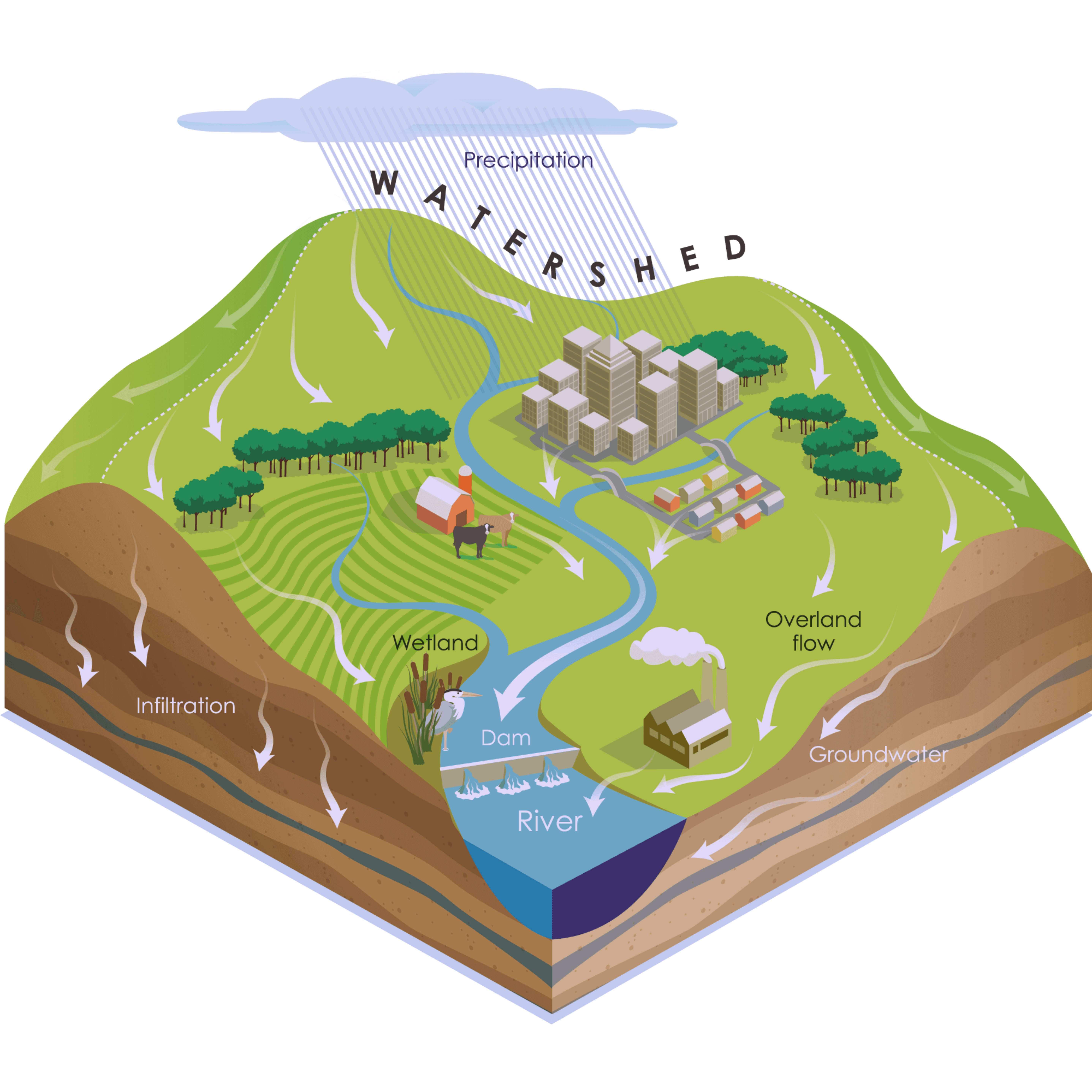
WHAT IS A WATERSHED?
A watershed is an area of land that drains to a common outlet. Water can drain or seep into a wetland, creek, stream, river, lake or infiltrate into the groundwater. Homes, farms, ranches, forests, small towns, big cities, culture, traditions, soil, and more make up a watershed. Watersheds come in all shapes and sizes and do not follow state or county lines, but drain according to the topography of the land. Some are millions of square miles; others are just a few acres. Watersheds connect adjacent areas and large watersheds are comprised of many smaller watersheds.
Delineating a Watershed
Have you ever wondered where rain goes when it falls? Stop sometime and watch a stream or river flowing by - does it end up in our drinking water? What things keep water clean in nature and in the water we drink? The land areas filter water naturally as it passes through on the surface or into ground water.
Waterbasins and watersheds are two ways that we classify water boundary units. Waterbasins are large land areas that are drained by a major river system. Watersheds are smaller land areas that are defined as the area that is drained by one stream or river. In order to collect background information on your watershed, you will probably want to get out in the field and take water quality measurements. You will first need to delineate the watershed boundaries.
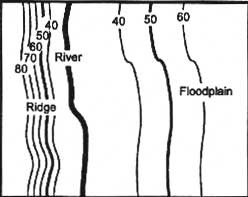
1) Use a topographic map to locate the river, lake, stream, wetland, or other waterbodies of interest.
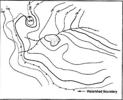
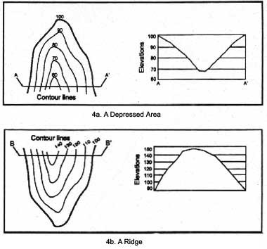
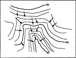
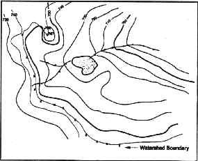
7) Connect the break points with a line following the highest elevations in the area. The completed line represents the boundary of the watershed.
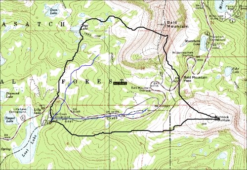
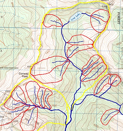
This presentation explains and illustrates how to identify and draw watershed boundaries on a topographic map. The process is explained step by step in the next 16 pages. You should review this presentation until you have a good understanding of the process and then test your watershed delineation skills using the two additional
topographic maps provided in pages 18 and 19 of this presentation.
The correct delineations (i.e., the answers) for those two watersheds are provided on the last two pages of this presentation (pages 20 and 21). Note that the delineation of the second test watershed is more difficult than that of the first because the landscape is flatter, which makes the features shown by the topographic lines less obvious.
Download this file: Watershed Delineation ![]()
Additional Information:
WV Watersheds: http://dep.wv.gov/WWE/getinvolved/sos/Pages/Watersheds.aspx
What is a Watershed: https://dep.wv.gov/WWE/getinvolved/sos/Pages/whatisawatershed.aspx